| In 2007 Jim Christianson wrote a grant to have this map, which was in Des Moines, scanned on a large flat bed scanner. Ten copies were made, framed and donated to Anamosa Library, Monticello Library, Jones County Historical Preservation Committee, Monticello Heritage Center, Jones County Engineer, Calkins Square, and the Historical Societies of Jones County, Olin, Oxford Junction and Wyoming. Now he has provided a copy of the scan for the Jones County Site. |

|
|
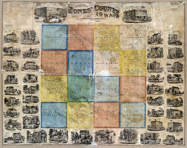
Click on the township name for an enlargement, the map will open in a new window. To enlarge more, click on the little magnifying glass icon while your cursor is over the map. To move around use the navigation bars. To return to this page, close the new window.
|
|

|